Search Results - Kansas.
Kansas
 Kansas ( ) is a landlocked state in the Midwestern region of the United States. It borders Nebraska to the north; Missouri to the east; Oklahoma to the south; and Colorado to the west. Kansas is named after the Kansas River, in turn named after the Kansa people. Its capital is Topeka, and its most populous city is Wichita, however the largest urban area is the bi-state Kansas City, MO–KS metropolitan area.
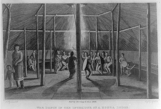
For thousands of years, what is now Kansas was home to numerous and diverse Indigenous tribes. The first settlement of non-indigenous people in Kansas occurred in 1827 at Fort Leavenworth. The pace of settlement accelerated in the 1850s, in the midst of political wars over the slavery debate. When it was officially opened to settlement by the U.S. government in 1854 with the Kansas–Nebraska Act, conflict between abolitionist Free-Staters from New England and pro-slavery settlers from neighboring Missouri broke out over the question of whether Kansas would become a free state or a slave state, in a period known as Bleeding Kansas. On January 29, 1861, Kansas entered the Union as a free state, hence the unofficial nickname "The Free State". Passage of the Homestead Acts in 1862 brought a further influx of settlers, and the booming cattle trade of the 1870s attracted some of the Wild West's most iconic figures to western Kansas.
As of 2015, Kansas was among the most productive agricultural states, producing high yields of wheat, corn, sorghum, and soybeans. In addition to its traditional strength in agriculture, Kansas possesses an extensive aerospace industry. Kansas, which has an area of is the 15th-largest state by area, the 36th most-populous of the 50 states, with a population of 2,940,865 according to the 2020 census, and the 10th least densely populated. Residents of Kansas are called ''Kansans''. Mount Sunflower is Kansas's highest point at . Provided by Wikipedia
-
201
Fate and transport of cyanobacteria and associated toxins and taste-and-odor compounds from upstream reservoir releases in the Kansas River, Kansas, September and October 2011
Published: U.S. Department of the Interior, U.S. Geological Survey, 2012Get full textDescription: 1 online resource (vi, 65 pages) : color illustrations, color map.
Government Document eBook -
202
Estimates of freshwater storage and potential natural recharge for principal aquifers in Kansas
Published: U.S. Dept. of the Interior, U.S. Geological Survey ; Books and Open-File Reports [distributor], 1991“…Kansas Water Office…”Description: vi, 100 pages : maps (some color) ; 28 cm.
Book -
203
Effects of pumping municipal wells at Manhattan, Kansas, on streamflow in the Big Blue and Kansas Rivers, northeast Kansas, 1992-94
Published: U.S. Dept. of the Interior, U.S. Geological Survey ; Information Services [distributor], 1997“…Kansas Water Office…”Description: viii, 62 pages : illustrations, maps ; 28 cm.
Book -
204
Constitution and by-laws of the Illinois Woman's Kansas Aid and Liberty Association. Organized June 10, 1856
Published: Daily Tribune Book and Job Office, 1856“…Illinois Woman's Kansas Aid and Liberty Association…”Description: 11 pages ; 12 x 18 cm.
Microfilm Book -
205
Report of the Board of Commissioners for the Investigation of Election Frauds. Appointed by the act of the Government and Legislative Assembly of Kansas Territory, of the 13th of J...
Published: C.H. McLaughlin, book and job printer, 1858“…Kansas. Board of Commissioners for the Investigation of Election Frauds…”Description: 142 pages, 1 . ; 17 x 13 cm.
Microfilm Book -
206
Veto message of Governor Medary, on the bill prohibiting slavery in Kansas
Published: [publisher not identified], 1860“…Kansas Territory. Governor (1858-1860 : Medary)…”Description: 16 pages ; 23 cm.
Microfilm Book -
207
Ground-water flow and solute transport in the Equus Beds area, south-central Kansas, 1940-79
Published: U.S. Dept. of the Interior, Geological Survey ; Open-File Services Section, Western Distribution Branch, 1985“…Kansas Geological Survey…”Description: x, 68 pages : illustrations, maps ; 28 cm.
Book -
208
Analysis of surface-water data network in Kansas for effectiveness in providing regional streamflow information
Published: Dept. of the Interior, U.S. Geological Survey ; For sale by the Books and Open-File Reports Section, 1987“…Kansas Water Office…”Description: iv, 28 pages : illustrations, 1 map ; 28 cm.
Government Document Book -
209
Potential hydrologic effects of ground-water withdrawals from the Dakota Aquifer, southwestern Kansas
Published: Dept. of the Interior, U.S. Geological Survey ; For sale by the Books and Open-File Reports Section, 1989“…Southwest Kansas Groundwater Management District No. 3.…”Description: vii, 47 pages : illustrations, maps ; 28 cm.
Government Document Book -
210
Floods in Kansas and techniques for estimating their magnitude and frequency on unregulated streams
Published: Dept. of the Interior, U.S. Geological Survey ; Books and Open-File Reports [distributor], 1987“…Kansas. Department of Transportation…”Description: iv, 50 pages : illustrations, maps ; 28 cm.
Book -
211
Measuring and computing natural ground-water recharge at sites in south-central Kansas
Published: Dept. of the Interior, U.S. Geological Survey ; Books and Open-File Reports [distributor], 1987“…Kansas Geological Survey…”Description: viii, 48 pages : illustrations, maps ; 28 cm.
Government Document Book -
212
Channel stability of the Neosho River downstream from John Redmond Dam, Kansas
Published: U.S. Dept. of the Interior, U.S. Geological Survey, 1999“…Kansas Water Office…”Description: 4 unnumbered pages : color illustrations, color map ; 28 cm.
Get full text
Get full text
Get full text
Government Document Book -
213
Water use in Kansas, 1990 and 1995
Published: U.S. Dept. of the Interior, U.S. Geological Survey, 1999Get full textDescription: 4 unnumbered pages : color illustrations, color map ; 28 cm.
Get full text
Get full text
Government Document Book -
214
Computer applications in the earth sciences
Published: State Geological Survey, University of Kansas, 1967“…Colloquium on Time-Series Analysis University of Kansas…”Description: 77 pages : illustrations ; 28 cm.
Conference Proceeding Book -
215
Geology and ground-water resources of Montgomery County, southeastern Kansas
Published: Kansas Geological Survey, 1974“…Kansas Geological Survey…”Description: 12 pages : illustrations, map ; 28 cm.
Book -
216
Saline water in the Little Arkansas River basin area, south- central Kansas
Published: Kansas Geological Survey, University of Kansas, 1976“…Kansas Geological Survey…”Description: iii, 24 pages : illustrations, maps ; 29 cm.
Book -
217
Subsurface geologic cross section from Meade County to Smith County, Kansas
Published: State Geological Survey of Kansas, 1953“…Kansas Geological Survey…”Description: 23 pages : illustrations, map ; 26 cm.
Government Document Book -
218
Subsurface geologic cross section from Barber County to Saline County, Kansas
Published: State Geological Survey of Kansas, 1949Description: 16 pages : illustrations, map ; 26 cm.Government Document Book -
219
Subsurface geologic cross section from Scott County, Kansas, to Otero County, Colorado
Published: State Geological Survey of Kansas, 1947Description: 11 pages : illustrations ; 26 cm.Government Document Book -
220
Subsurface geologic cross section from Trego County, Kansas, to Cheyenne County, Colorado
Published: State Geological Survey of Kansas, 1947Description: 8 pages : illustrations ; 26 cm.Government Document Book